Rethinking Refugee Communities
Ennead Lab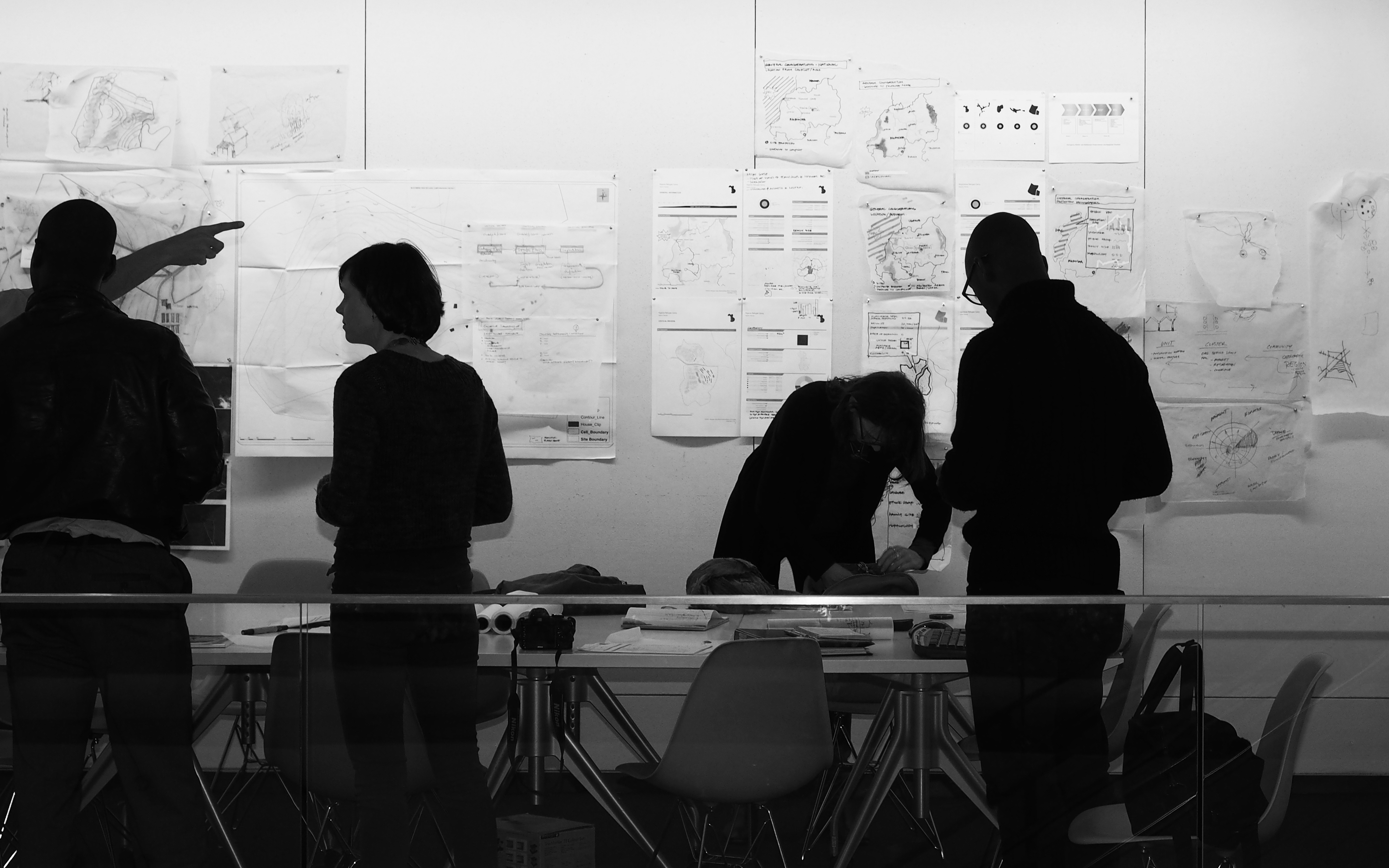
Rethinking Refugee Communities, leveraging multi-disciplinary expertise to create an integrated framework for rapidly building suitable environments for the most vulnerable communities across the globe.
Architects are most often concerned with the resulting artifact of the design process. Rethinking Refugee Communities presented an extraordinary opportunity to design the design process. In collaboration with the United Nations High Commissioner for Refugees (UNHCR) and Stanford University, our team at Ennead Architects set out to design a toolkit for UNHCR settlement planners, the architects of refugee camps, to more readily respond to the broad range of settlement planning issues in wildly varying environmental conditions.
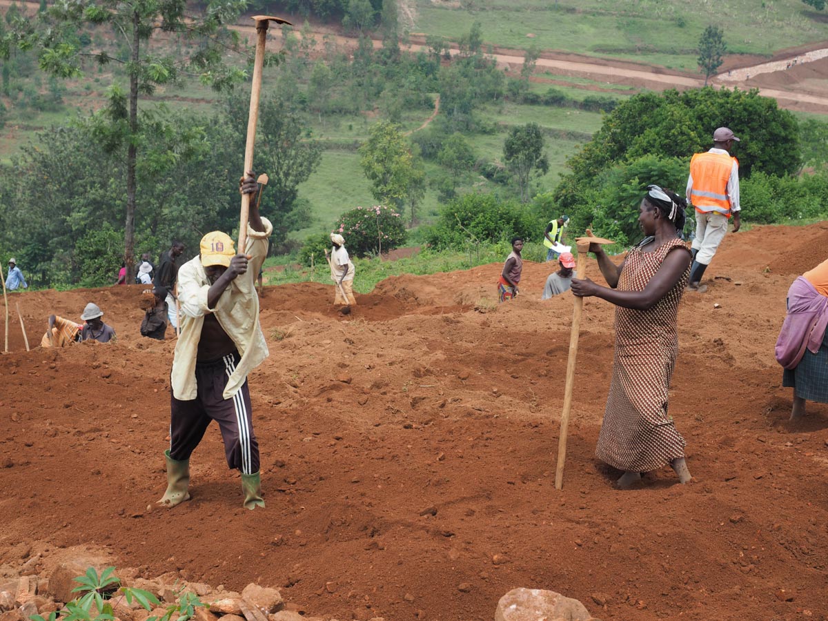
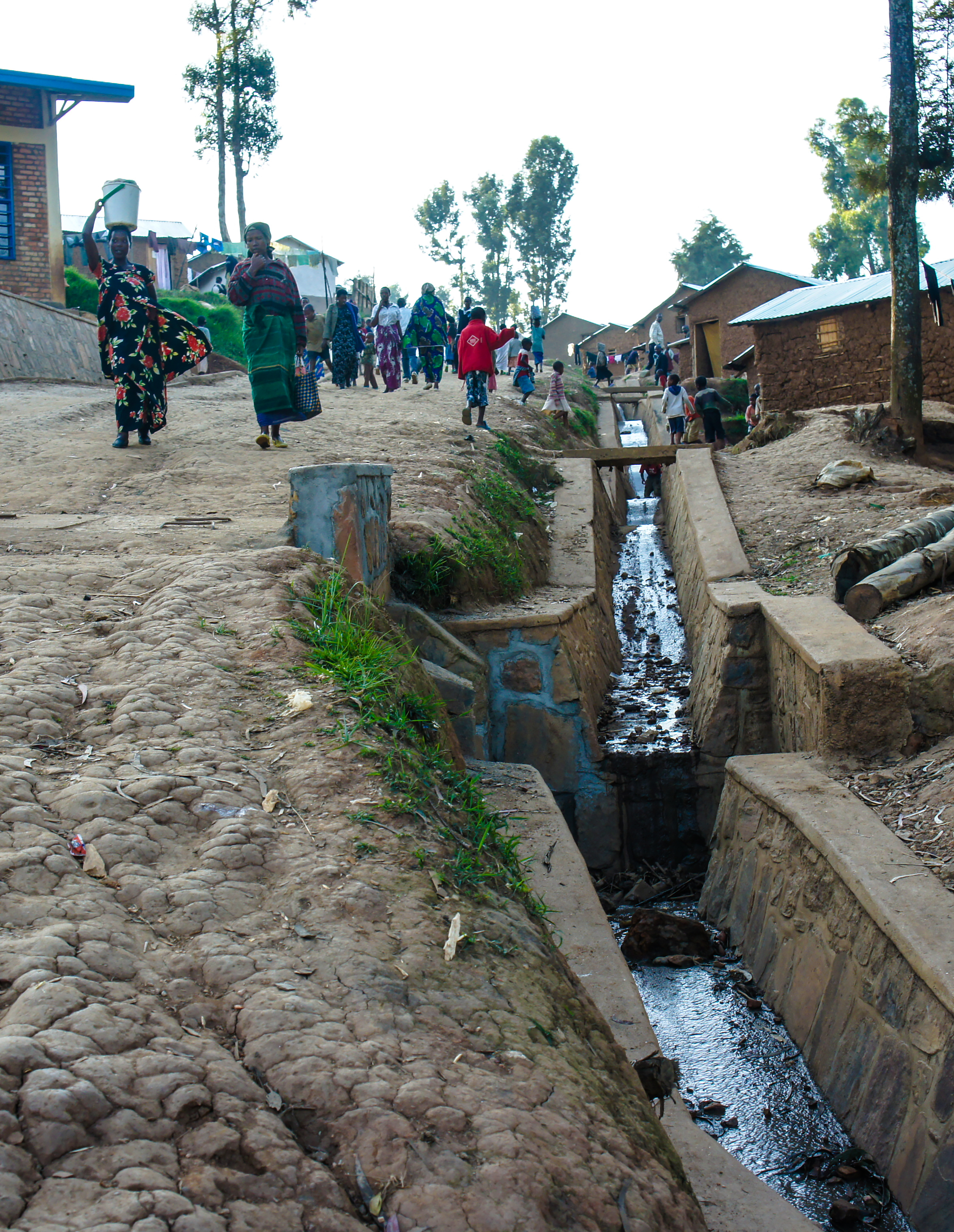
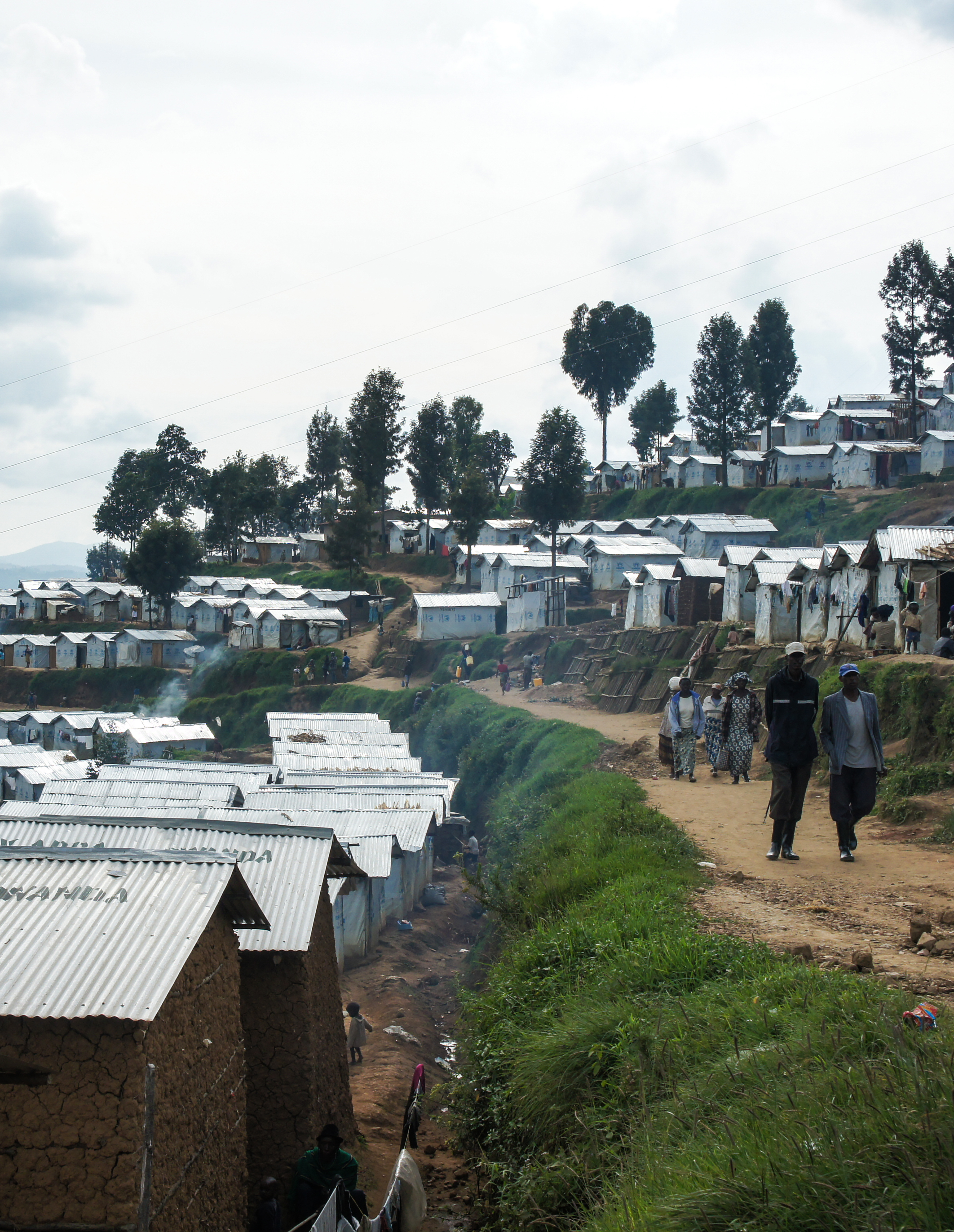
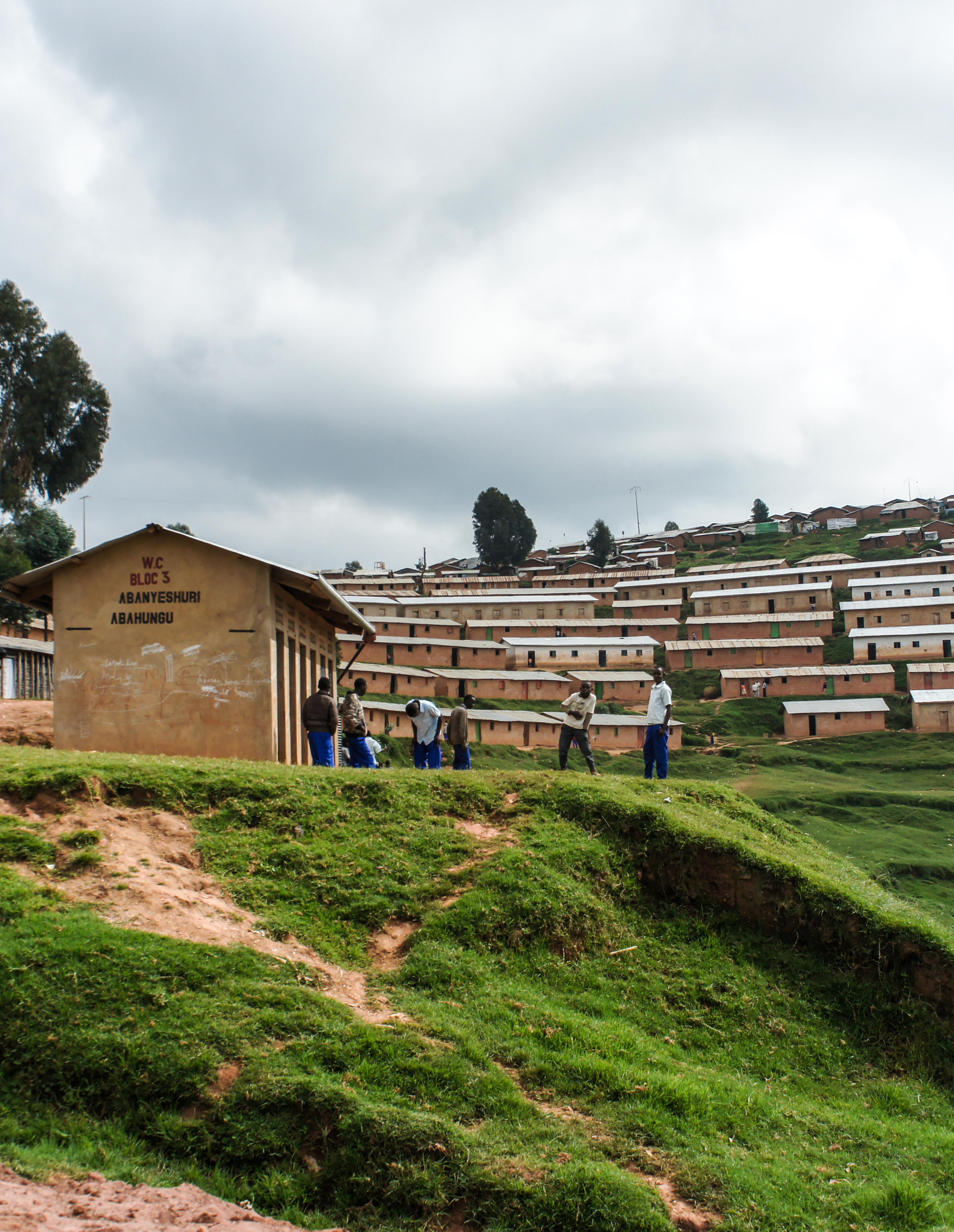
Refugee settlements designed as temporary environments are anything but that. Refugees spend anywhere from one to forty years in conditions designed for a lifespan a fraction of that time. Developing a holistic planning methodology that approached settlements with an awareness that they were long-term, city-like environments, while contending with the exigencies of the emergency, was the task ahead of our team.
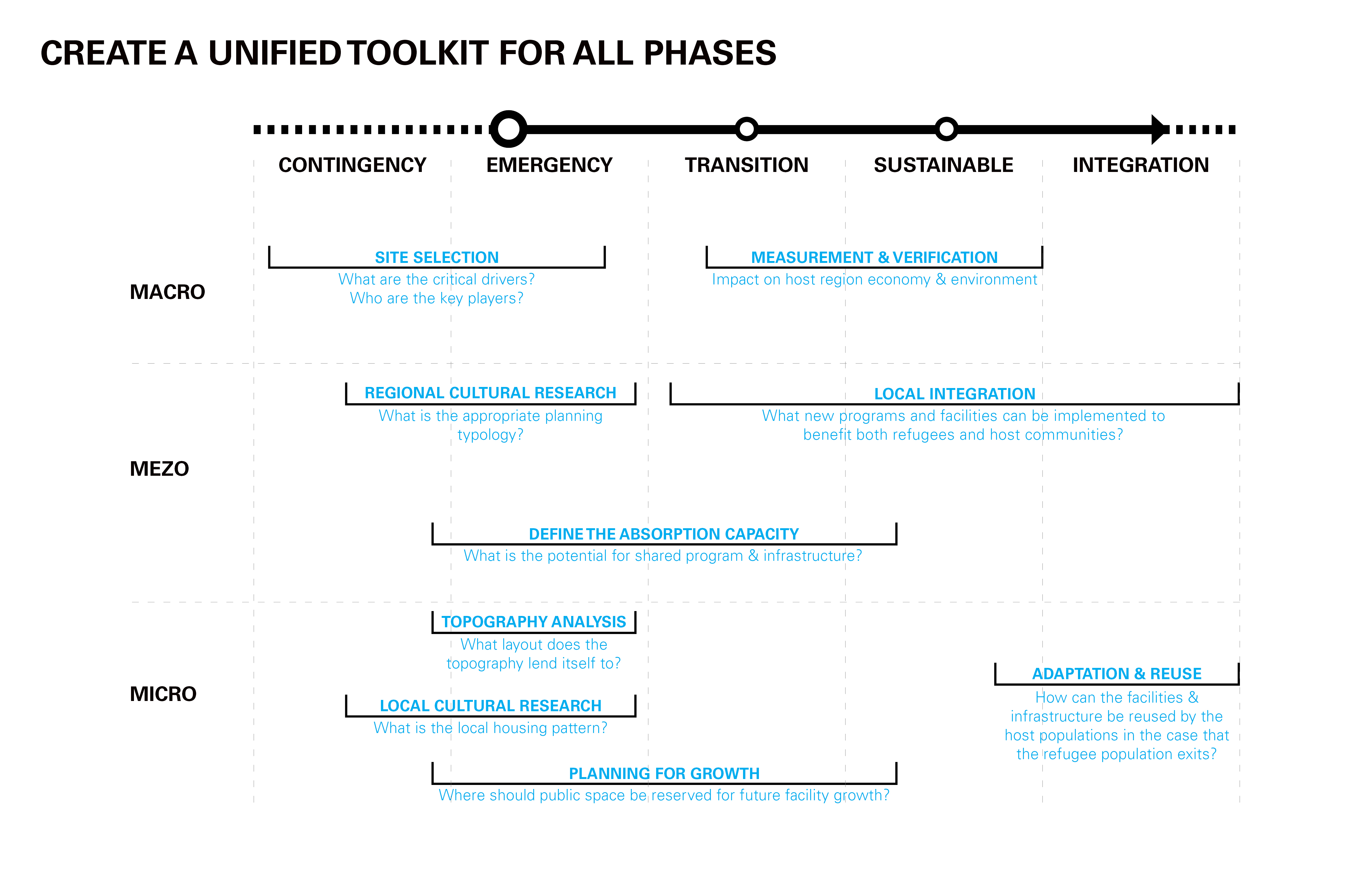
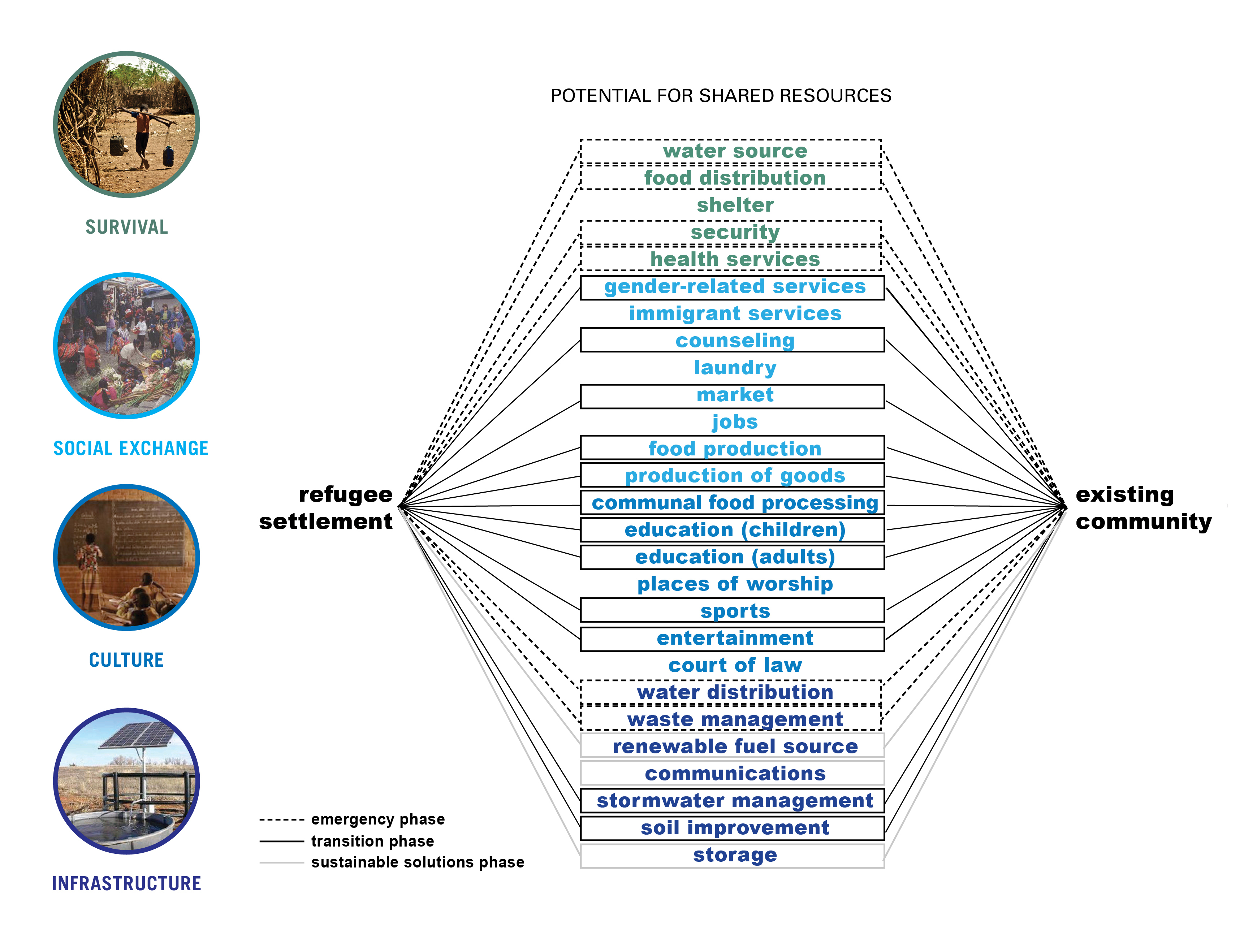
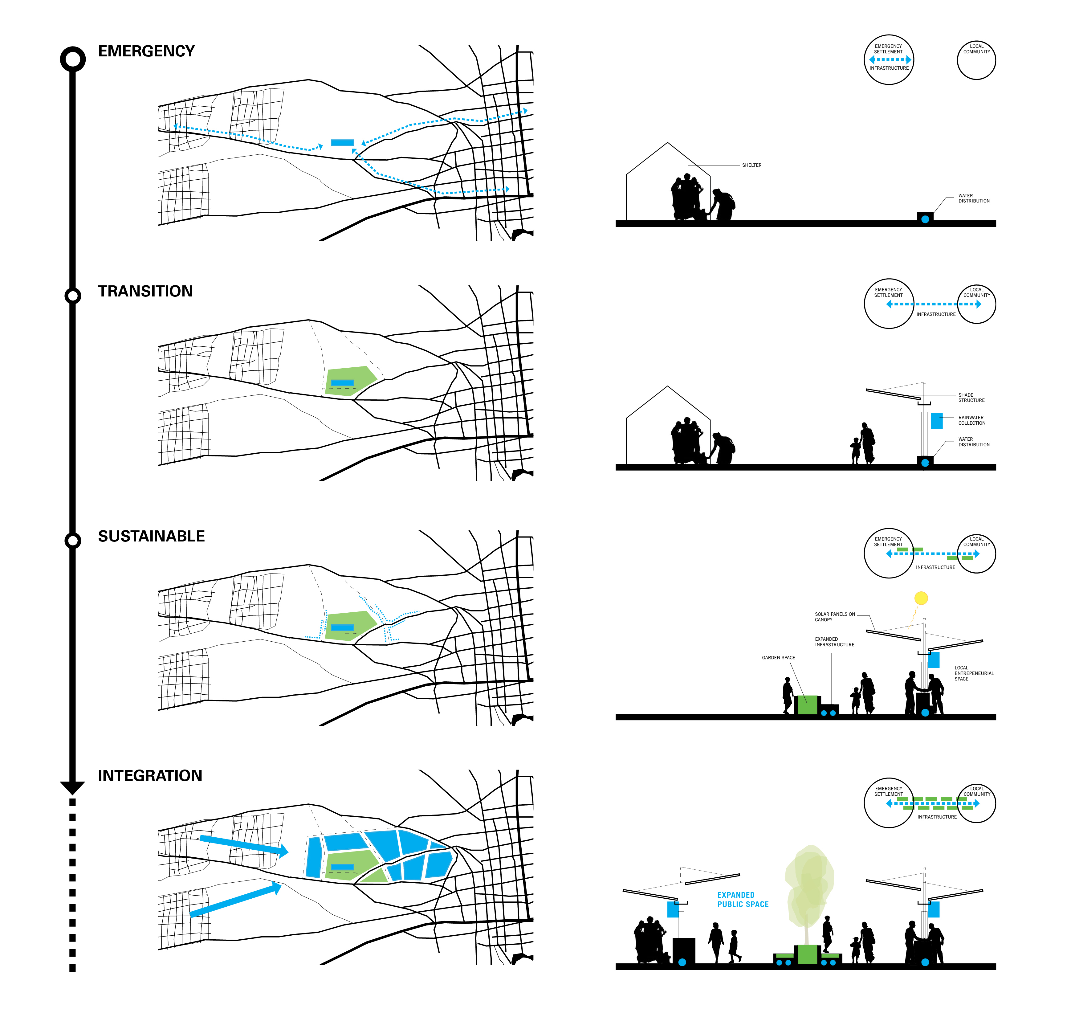
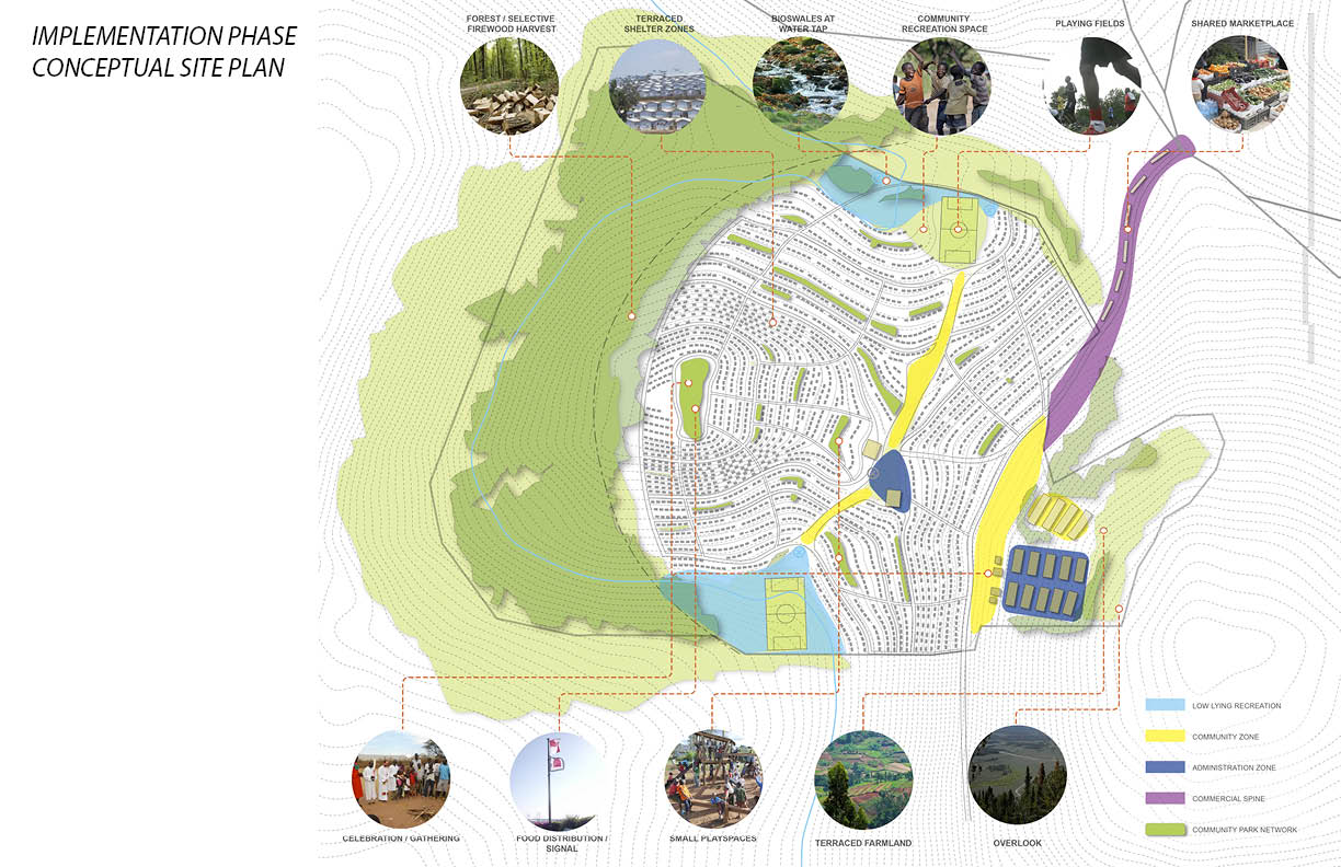
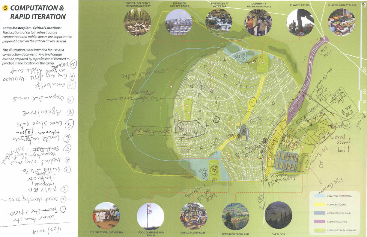
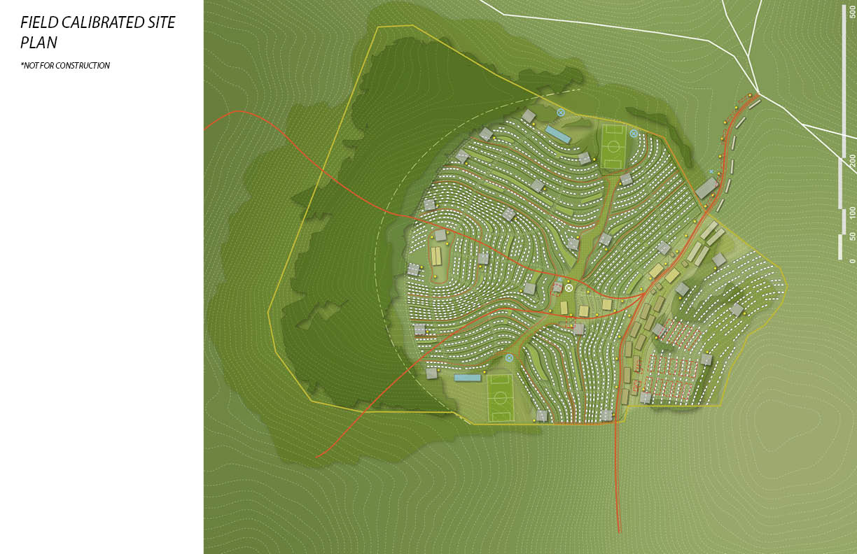
(Above) Vignettes of the UNHCR toolkit, including GIS macro analysis and vignettes of regional and site planning strategies.
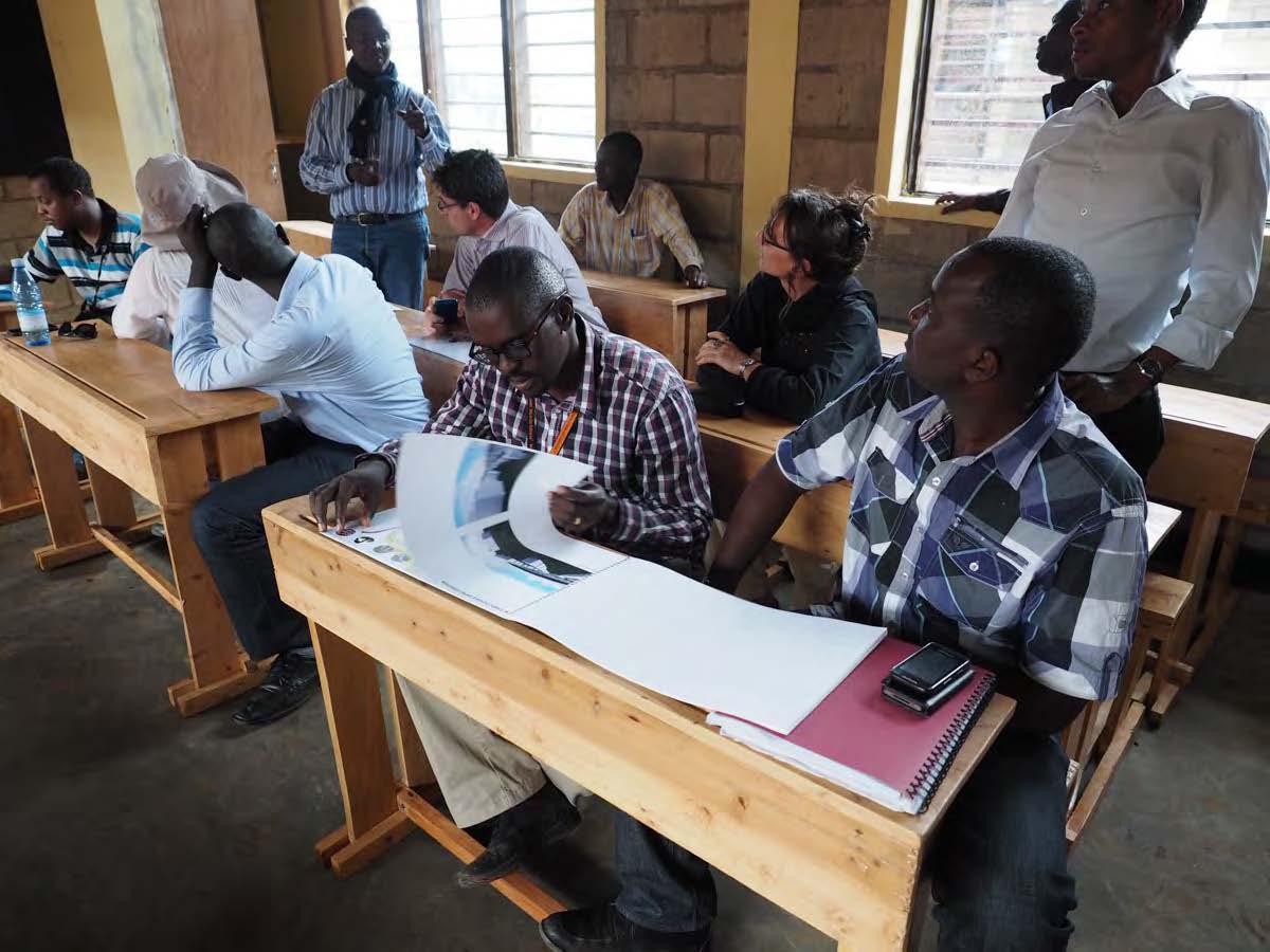
(Below) UN intensive charette at Ennead.
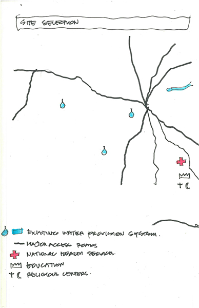
(Below, Right)UN charette sketches. During the charette our team worked with UNHCR planners and Landscape Architect Susannah Drake to investigate refugee particularities and landscape concerns while developing a holistic planning methodology.
(Below, Right)UN charette sketches. During the charette our team worked with UNHCR planners and Landscape Architect Susannah Drake to investigate refugee particularities and landscape concerns while developing a holistic planning methodology.


Using Google Earth, the topography of proposed sites can be extracted and used for further analysis. With parametric tools, we established routines for processes such as contour map generation and slope analysis. This enabled the team to swiftly evaluate the suitability of sites and assess landscape challenges.
Time is unfathomably scarce when planning refugee settlements. A core tenet of the toolkit is informed high-speed decision making. To fulfill this tenet, we created a framework for determining the critical design drivers in any given refugee resettlement scenario. Our toolkit framework divides settlement planning into three distinct categories;
1.Settlement site analysis
2.Local resource assessment
3.Site design
1.Settlement site analysis
2.Local resource assessment
3.Site design
We codified the macro-scale analysis into a numerical rating system that assesses factors critical to sustaining a settlement community, such as access to freshwater and vehicular site access, among additional criteria. We developed a taxonomy of regional planning strategies that acknowledged the considerable influence of resource sharing and community integration considerations at the mezzo scale. At the micro-scale, We augmented the UNHCR team's site design capabilities by producing both an expandable catalog of best practices - presented as diagrammatic vignettes- and a set of custom computational design tools.
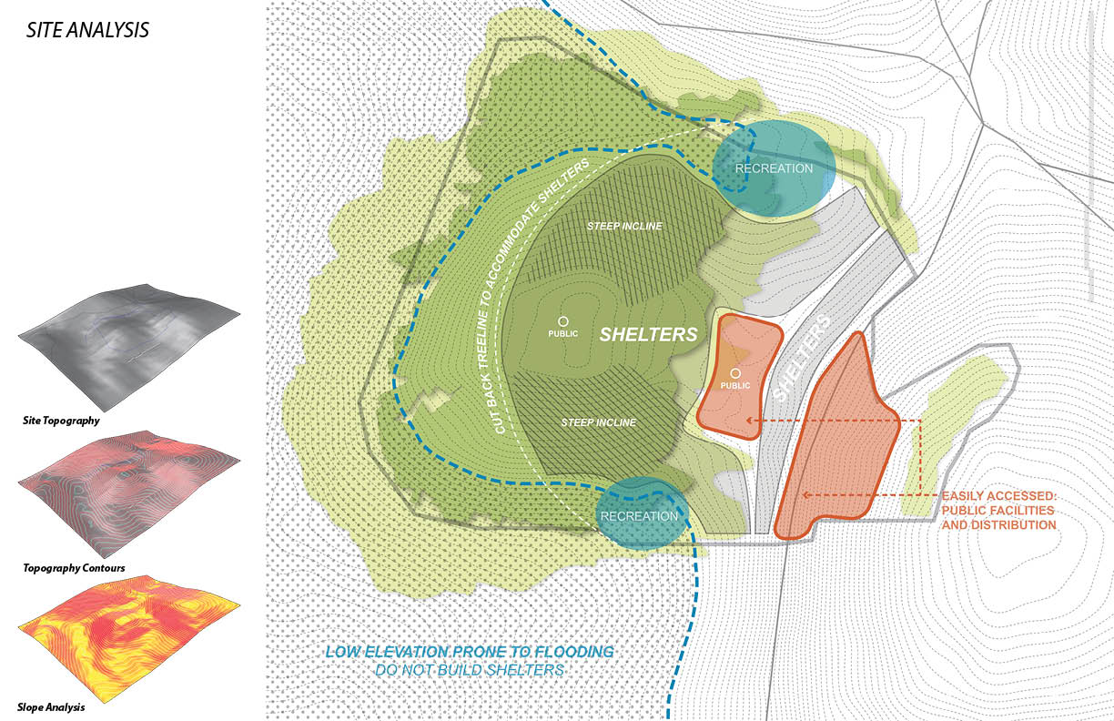
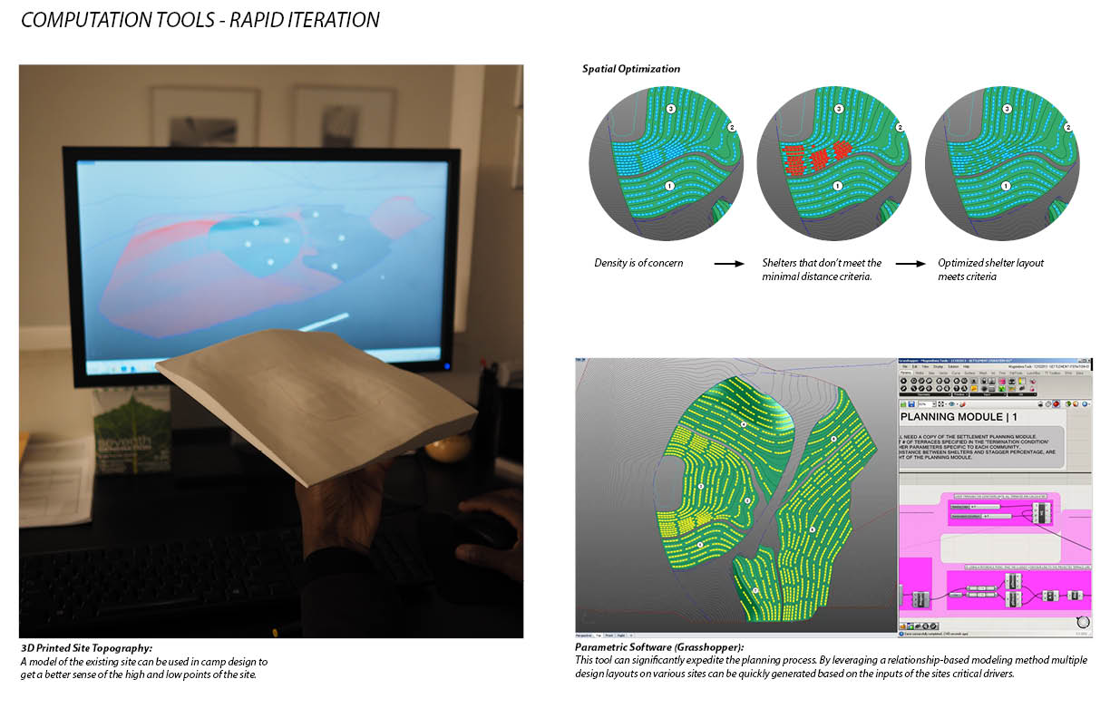

Equipped with a contour map, our team analyzed the drainage patterns of the significantly mountainous landscape, identifying watersheds and establishing zones for various use types within the settlement.
Once we established shelter zones, we were able to automate the development of both site grading scenarios and shelter layouts. Compared to the conventional UNHCR process, these methods allowed us to test fit multiple sites for a given crisis in a fraction of the time.


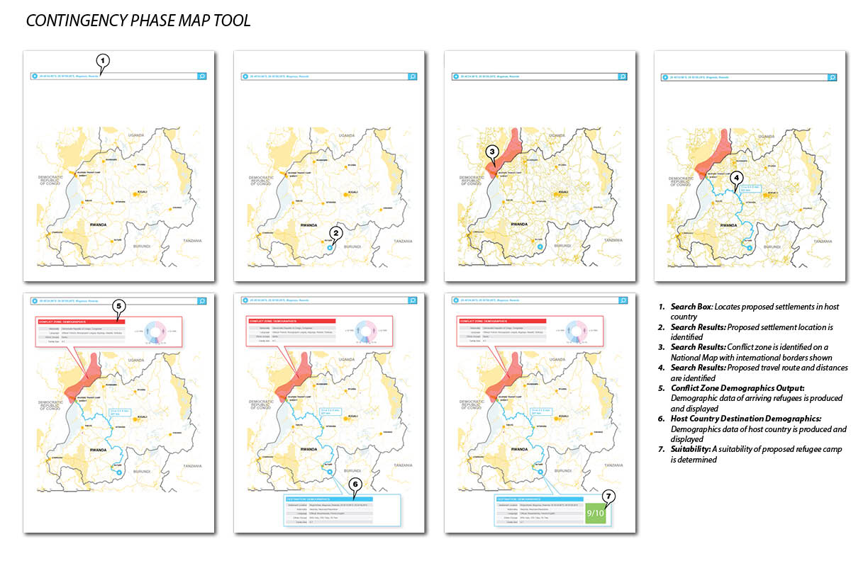
The entire toolkit leverages open-source information databases to supplement the lack of time in the planning process. GIS and terrain data is processed and folded into a design process that utilizes computational design tools; This rapidly accelerates an informed, iterative methodology, tuned to the specificities of a given site.
Notes about my role
I served as an Architectural and Computation Designer. My role focused on exploring ways that we could leverage computational processes as we developed a rapid-response framework for the design of refugee communities. I was responsible for researching methods to leverage relevant open-source data platforms and the development of algorithms that could piggyback on open source topographical data specifically to automate the layout of settlements.
I served as an Architectural and Computation Designer. My role focused on exploring ways that we could leverage computational processes as we developed a rapid-response framework for the design of refugee communities. I was responsible for researching methods to leverage relevant open-source data platforms and the development of algorithms that could piggyback on open source topographical data specifically to automate the layout of settlements.
Client
Confidential
Typology
Organizational Design, Design Thinking Workshops,
Location
New York, NY
Size
N/A
Timeline
2018
Status
Complete
Program
Regional analysis tools, resources assessment framework, computational planning tools, visual catalogue of urban, landscape, and sustainable design strategies.
Michael Caton, RA, AIA, LEED AP BD+C, CDTP